

THE CENTRAL GERMAN UPLANDS
OVERVIEW
The Central German Uplands, also known as the Mittelgebirge, is a range of low mountains and hills that stretch across much of central Germany. This diverse region includes several mountain ranges, such as the Harz, the Thuringian Forest, and the Black Forest, as well as high plateaus and river valleys.
FORMATION HISTORY
The Central German Uplands (Deutsches Mittelgebirge)) are older than the Alps and differ from them in elevation and structure. Their geological history has been ongoing for over 300 million years. The formation of the Central German Uplands started during the Carboniferous period, a time when the Earth's continents were still forming and the supercontinent Pangea was in the process of being created. At this time, the former continents Laurasia (which would later become North America) and Gondwana collided with each other, creating a vast orogenic event that led to the formation of the Central German Uplands.
The Central German Uplands are fault-block mountains, which means they were formed by the fracturing and shifting of the Earth's crust along large-scale faults. This is in contrast to the Alps, which are fold mountains formed by the collision of tectonic plates. The faulting and fracturing of the Earth's crust during the Carboniferous period created the mountain base of the Central German Uplands.
Over time, denudation processes such as erosion began to level the mountain range. However, the formation of the Alps, which occurred much later in Earth's history, put pressure on the Central German Uplands, causing the former high mountains to be raised again and shattered into lots of blocks. This resulted in the formation of the distinct mountain ranges that we see today in the region, including the Harz, the Thuringian Forest, and the Black Forest.
The highest peak in the Central German Uplands is the Brocken in the Harz Mountains, which stands at just over 1,100 meters above sea level. This is in contrast to the Alps, which have numerous peaks that exceed 4,000 meters.
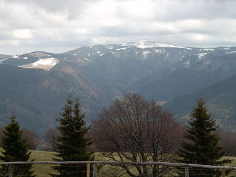
The Central German Uplands exhibit a wide range of elevations, ranging from 1640 feet (500 meters) in the Teutoburger Wald to the highest peak of 4898 feet (1493 meters) in the Black Forest mountain range (Schwarzwald), where the Feld Mountain (Feldberg) is located. The Black Forest is not only the highest low mountain range in Germany, but also the country's largest forested area, dominated by firs and spruces. This makes it a popular destination for skiing and snowboarding, among other outdoor activities.
RECREATIONAL ACTIVITIES

The Central German Uplands offer a wealth of recreational opportunities for visitors. The numerous parks, trails and preserved areas make it a popular destination. One of the most famous national parks is the Bavarian Forest, located in the southeastern part of the region. It is one of the largest forested areas in Europe, and visitors can enjoy hiking, cycling, and skiing in the winter months. Another popular destination is the Rhön (Rhoen Mountains), located in the heart of Germany. The region offers excellent opportunities for hiking and mountain biking. The area is also home to several spa towns, which offer visitors a chance to relax and rejuvenate.
The town of Oberwiesenthal in the Ore Mountains (Erzgebirge) is the highest health resort in Germany. This picturesque town is located in a beautiful mountain setting and offers a wide range of recreational activities such as skiing, snowboarding, and ice skating.
In addition to outdoor activities, the Central German Uplands also offer visitors a chance to explore the region's rich cultural heritage. The region is home to several historic towns and cities, including Erfurt and Weimar.
Overall, the Central German Uplands offer something for everyone, whether you're interested in outdoor activities, spa treatments, cultural or historical experiences.
NATURAL RESOURCES
The rich deposits of iron ore, copper, tin, lead, silver, and gold have played a crucial role in the region's industrial development. The exploitation of these resources started in the Middle Ages and continued into the modern era. The mining and processing of these minerals created jobs and wealth in the region, making it one of the most important industrial centers in Germany.
Iron ore was one of the most important resources in the region, and it was extensively mined in the Harz Mountains. The extracted iron was used for the production of steel, which was then used for various industrial purposes. Copper was another important resource, and it was mainly extracted in the Westerwald Mountains. Copper was used for electrical wires, plumbing, and various other purposes.
Tin was also mined in the region, and it played a crucial role in the production of bronze. Lead was extracted in large quantities and used for pipes, roofing, and batteries. Silver and gold were also extracted from the region, and they were used for various purposes, such as making jewelry and coins.
Apart from minerals, the Central German Uplands also have vast forests of firs and spruces. The timber from these forests has been used for building houses, furniture, and various other products.
CLIMATE
The climate in the Central German Uplands is generally characterized as being temperate, with mild summers and cold winters. Compared to the North German Lowlands, the region experiences slightly cooler temperatures and higher amounts of precipitation throughout the year. This is due to the region's location further inland and its elevation, which causes moist air masses from the Atlantic to be lifted and cooled, resulting in more rainfall. On average, the Central German Uplands receive more precipitation than the North German Lowlands, with annual rainfall averaging between 800 and 1200 millimeters. This precipitation is distributed relatively evenly throughout the year, although the summer months tend to be slightly drier than the rest of the year.
In terms of temperature, the Central German Uplands experience a significant cooling effect as elevation increases. This means that temperatures are generally cooler in higher elevations, and can even be several degrees cooler than temperatures at lower elevations.
ELEVATIONS
| Highest elevation |
Mountain range |
State |
| The Feldberg (1493m) |
Black Forest (Schwarzwald)
|
Baden-Württemberg |
| Großer Arber (1456m) | Bavarian Forest (Bayerischer Wald) | Bavaria |
| Keilberg (1243m) | Erz Mountains (Erzgebirge) | Saxony |
| Brocken (1141m) | Harz | Lower Saxony; Saxony-Anhalt, Thuringia |
| Schneeberg (1053m) | Fichtel Mountains (Fichtelgebirge) | Bavaria |
| Schwarzkopf (1041m) |
Upper Palatine Forest (Oberpfälzer Wald) |
Bavaria |
| Lemberg (1015m) |
Swabian Alps (Schwäbische Alp) |
Baden-Württemberg |
DISTINCTIVE MOUNTAINS
The Eifel, Hunsrueck Mountains, Taunus, Westerwald, Bergisches Land and Sauerland are part of the Rhenish Slate Mountains.
The Swabian Alps (Schwäbische Alb), the Franconian Mountains (Fränkische Alb) and the Bavarian Forest (Bayerischer Wald) are mountain ranges in the south.
Other important mountain ranges are Harz, Rhoen Mountains (Rhön), Thuringian Forest (Thüringer Wald) and Erzgebirge.
VOLCANIC REGIONS
The Central German Uplands boast of several regions that were formed due to volcanic activities. One of the most prominent volcanic regions in the area is the Eifel, located in western Germany. The volcanic regions in the Central German Uplands offer visitors a chance to witness some of the most spectacular geological formations in the area. The volcanic activity in the Eifel started more than 40 million years ago and continued for several million years, resulting in the formation of various volcanic structures, including maar lakes, basalt lava flows, and volcanic cones. The most recent eruption in the Eifel occurred around 13,000 years ago, resulting in the formation of a caldera that eventually filled with water to form the beautiful Laacher Lake.
Another volcanic region in the Central German Uplands is located in the Upper Palatinate region of Bavaria. This region is known for its extensive volcanic activity that occurred around 20 million years ago, around the same time the Alps were forming due to the collision of the African and European plates. The volcanic activity in this region led to the formation of several volcanic structures, including shield volcanoes, lava domes, and volcanic plugs. Some of the most famous volcanoes in the region include the Parkstein volcano, the Rauher Kulm, and the Staffelberg.
RIVERS
The Central German Uplands are also home to several rivers that rise or flow through the region, providing a vital source of water and irrigation for the area. The rivers also serve as popular destinations for water-based recreational activities, such as fishing, swimming, canoeing and boating.
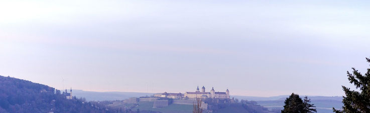
The Main River is a significant river in Germany that flows through the Central German Uplands. It is the longest right tributary of the Rhine River and rises in the Fichtel Mountains in Upper Franconia. From there, it flows through several major cities, including Bayreuth, Bamberg, Würzburg, and Frankfurt, before finally merging with the Rhine River at Mainz. The Main River has a total length of about 525 kilometers (326 miles) and plays an important role in transportation and commerce, as it is navigable for large vessels up to the city of Frankfurt. It also provides a source of water for irrigation and other agricultural purposes in the surrounding areas.
The Saale River, which rises in the Fichtelgebirge Mountains in Bavaria, flows through the states of Thuringia and Saxony-Anhalt before joining the Elbe River. The Saale River is approximately 413 kilometers long and is an important tributary of the Elbe River. Along its route, the Saale River passes through several scenic areas, including the Saale-Unstrut wine region and the Saale valley.
Another notable river in the Central German Uplands is the Werra River, which rises in the Thuringian Forest and flows through the states of Thuringia, Hesse, and Lower Saxony before joining the Fulda River to form the Weser River. The Werra River is approximately 299 kilometers long and passes through several scenic areas, including the Werra Valley.
In addition to the Main, Saale, and Werra Rivers, there are several other smaller rivers and streams that flow through the Central German Uplands, including the Ilm, Eger, and Lahn Rivers. These rivers and streams provide important ecological, economic, and recreational benefits for the region and play a vital role in shaping its landscape and culture.
| river | length | head | flows into the ... |
| Danube |
2888 km (647 km in Germany) |
Black Forest
|
Black Sea |
| Weser |
750 km |
Thuringian Forest |
North Sea |
| Main |
524 km |
Fichtel Mountains |
Rhine |
| Saale |
413 km |
Fichtel Mountains |
Elbe |
| Ems |
371 km |
Teutoburg Forest |
North Sea |
| Neckar |
367 km |
Black Forest |
Rhine |
| Eger |
316 km |
Fichtel Mountains |
Elbe |
| Werra |
298 km |
Thuringian Forest |
Weser |
| Mulde |
290 km |
Erz Mountains |
Elbe |
| Lahn |
250 km |
Rothaar Mountains |
Rhine |